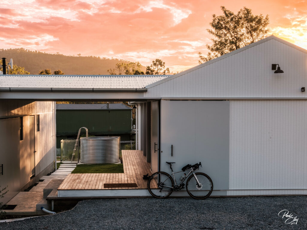
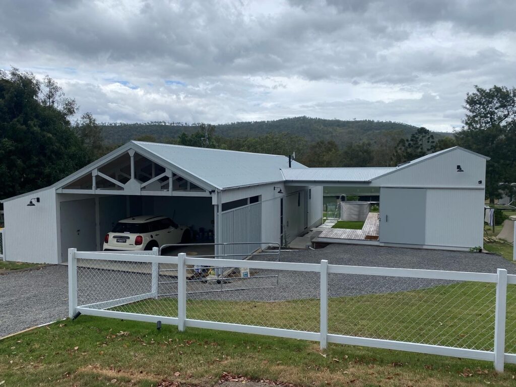
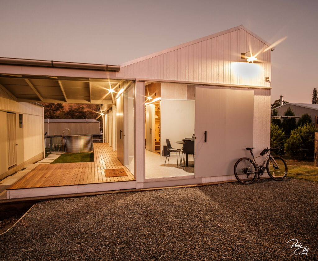
A brand new architecturally designed, purpose built small scale accommodation for cyclists and other adventurers of the Brisbane Valley Rail Trail (BVRT)
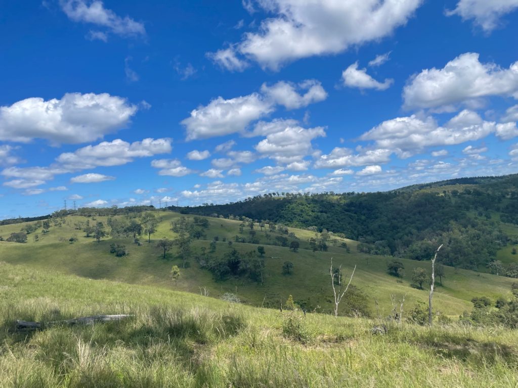
The Rail Trail Refuge is in the quaint village of Linville. Linville is an appealing destination for cyclists as it is on the BVRT and there are plenty of other scenic and adventurous rides around the region. Nestled in the valley of the Brisbane River, the ranges on each side of the town glow in the amazing sunrises and sunsets. Red deer can be spotted in early mornings as you head up Mt Stanley Road which criss-crosses the Brisbane River over 30 times. At the heart of the town is the iconic Linville Hotel which makes the ideal dinner spot, only a 400m roll or stroll from your bed.
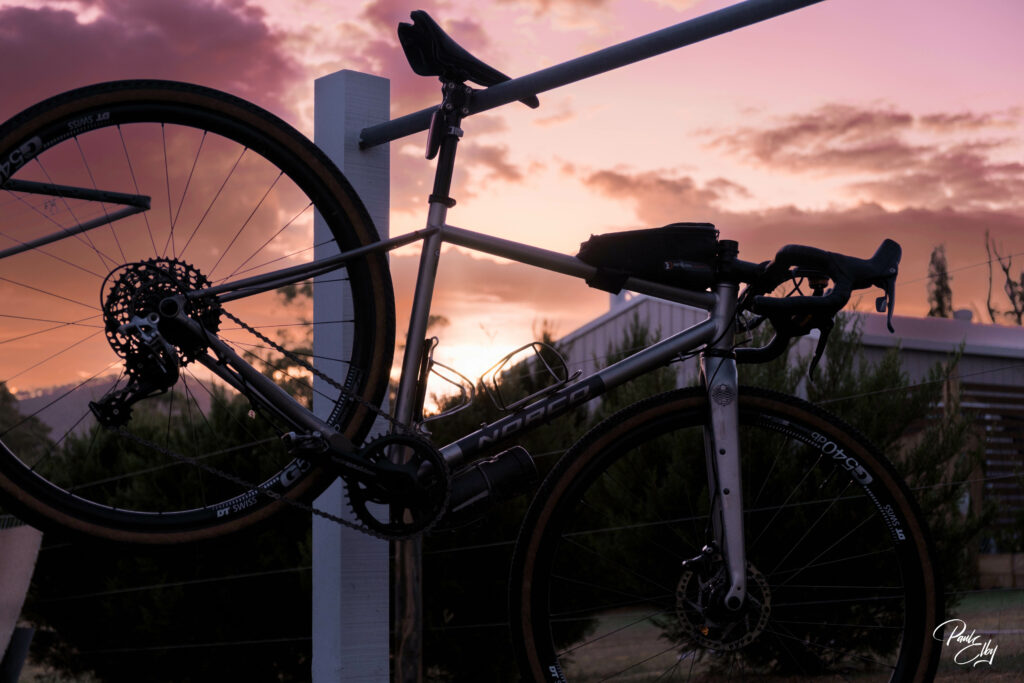
Leave the car and travel by bicycle
It is really rewarding to reach your destination under your own steam, often the journey is the most amazing part of the trip. Wulkuraka Station at the southern end of the BVRT is accessible by Citytrain. Out There Cycling and other businesses provide transfers to Linville and other towns along the BVRT.
If travelling under your own steam is not an option, then off-street car parking is available.
To help plan your adventure check out the following websites.
The Rail Trail Refuge acknowledge the following groups that help promote, advocate, maintain and improve the BVRT.


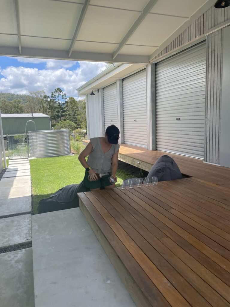
Accommodation
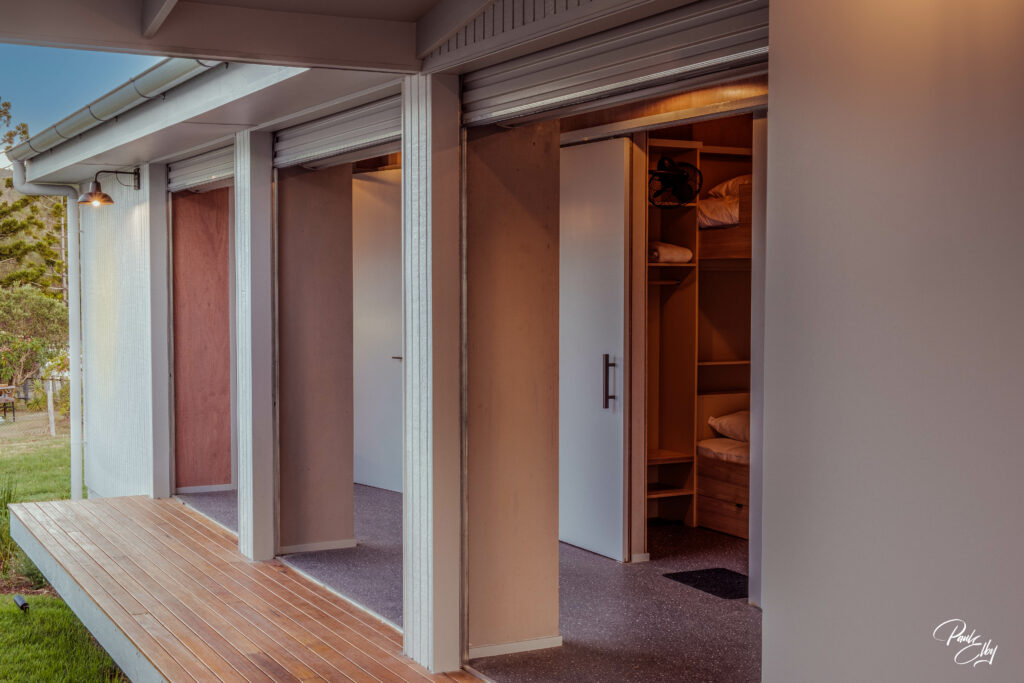
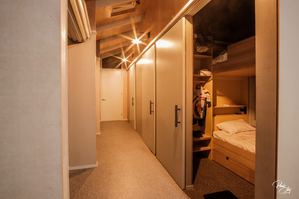
The Rail Trail Refuge is ideal for single travellers or small family or friendship groups. The Rail Trail Refuge can accommodate up to 6 people. It has been designed primarily for cyclists so it may not suit everybody.
Inclusions
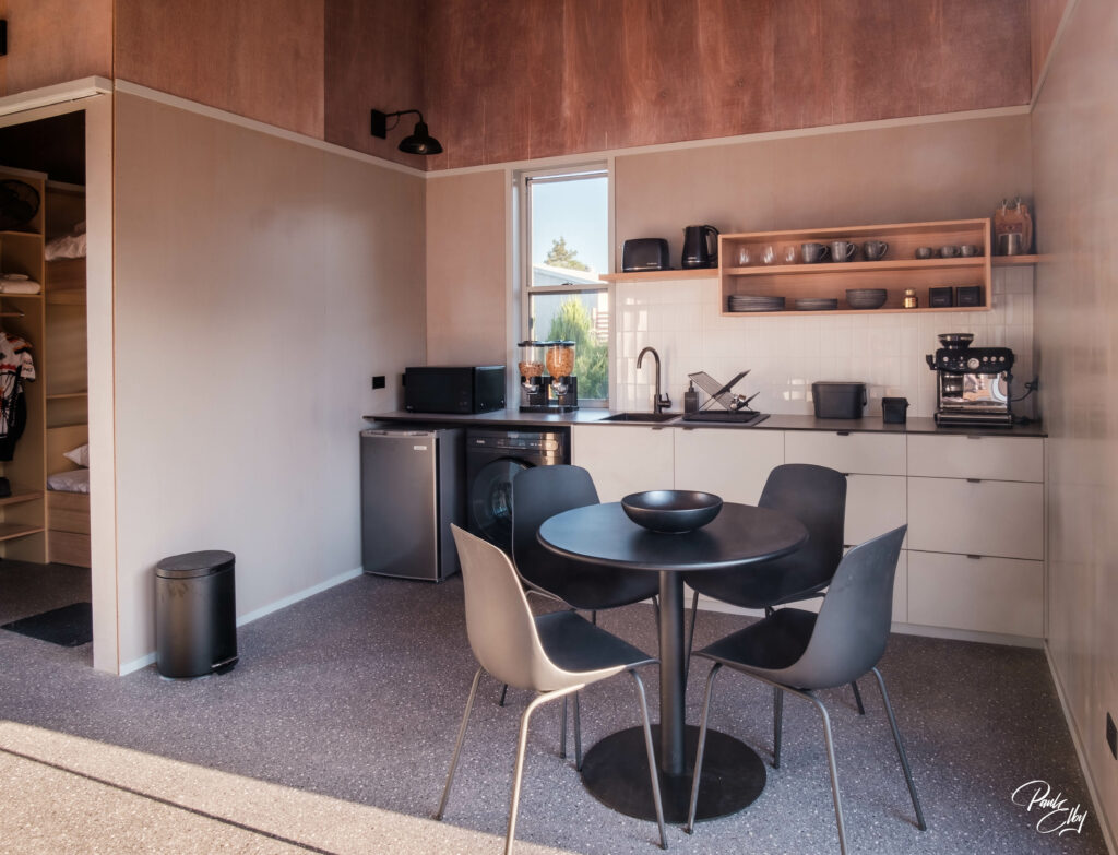
- Continental breakfast (toast, spreads, yoghurt, muesli, fruit, juice, tea, espresso)
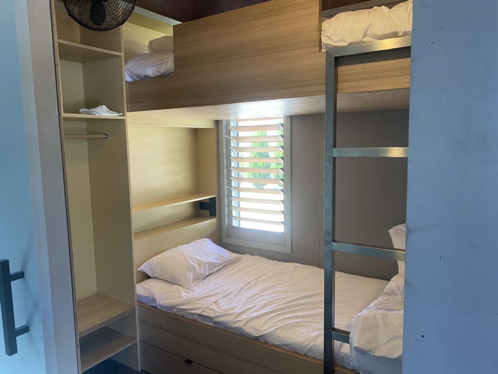
- Each bunkroom contains comfortable king single bunks, high ceilings, wall fans, usb power points and shelves.
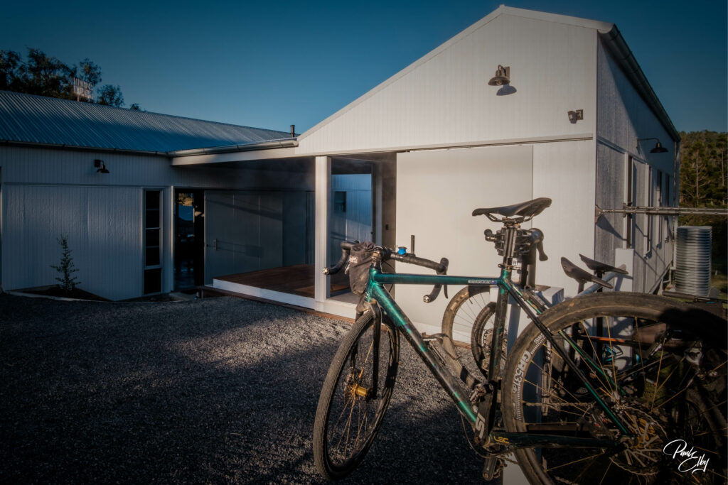
- Undercover bike storage (steadyracks) with powerpoint access for ebike charging just outside rooms.
- Linen - bedding, towels
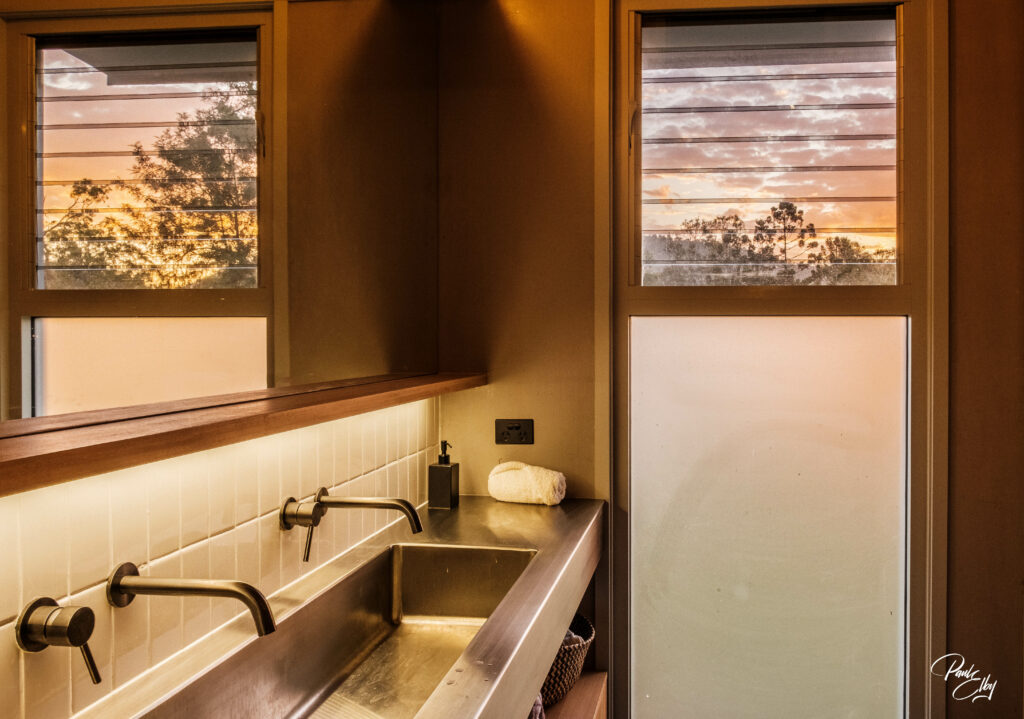
- Communal Bathroom with separate toilet and shower and large vanity
- Basic toiletries (soap, shampoo, conditioner)
- Outdoor bike parking with maintenance/ washing rack. Bike washing equipment and basic tools available to guests.
- Communal kitchen with fridge, microwave, espresso machine, washing machine/ dryer
- Wi-Fi
- Clothesline
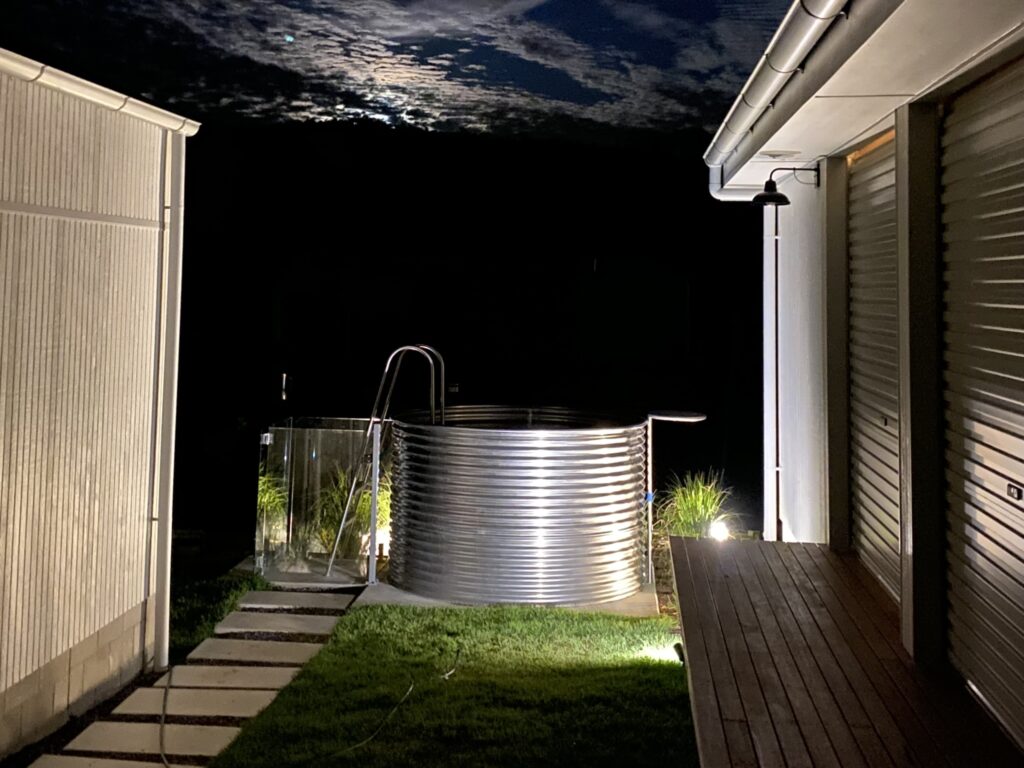
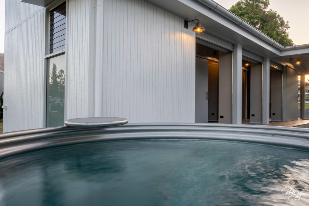
- Plunge pool
- Fire pit
- Chill out area
- Yoga mats for post ride stretching
- On site manager with local knowledge and bike industry experience.
Book Now
PLEASE NOTE:
Accommodation: Not recommended for young children or people with severe mobility impairment.
Pets: No pets allowed, exceptions for assistance animals.
Smoking: No smoking within 5 metres of buildings.
Limited car parking on site: Walk in or ride in preferred. Transfers available via Out There Cycling.
Arrival and Departure: Check in from 2pm - Check Out prior to 10am
Luggage: Drop offs and storage welcome outside of check in hours on arrangement.
General cancellation policy:
Cancel up to 30 days before arrival date for a full refund.
Cancel up to 10 days before arrival date for a 50% refund.
Searching Availability...
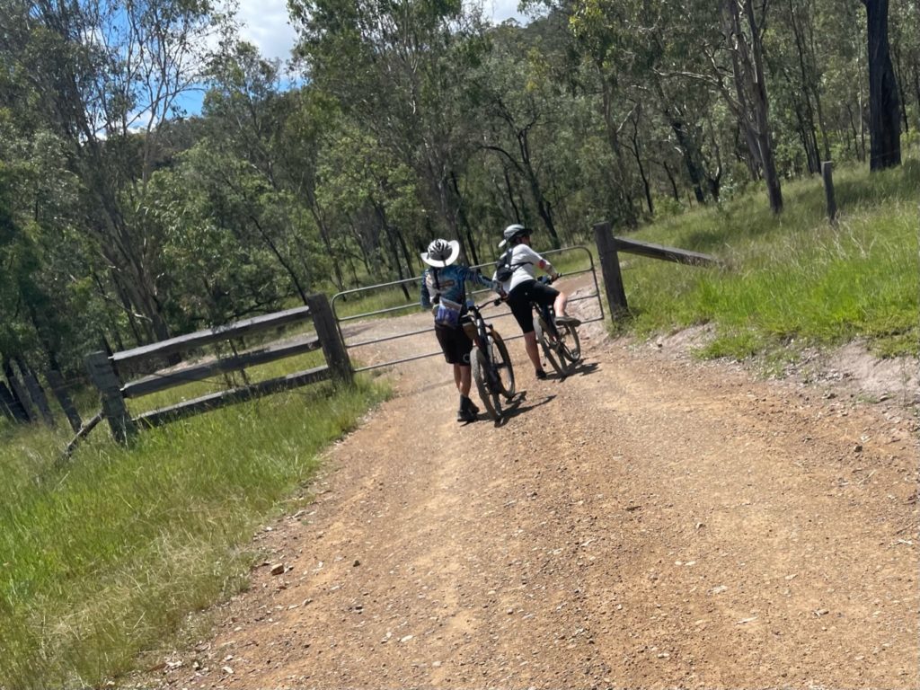
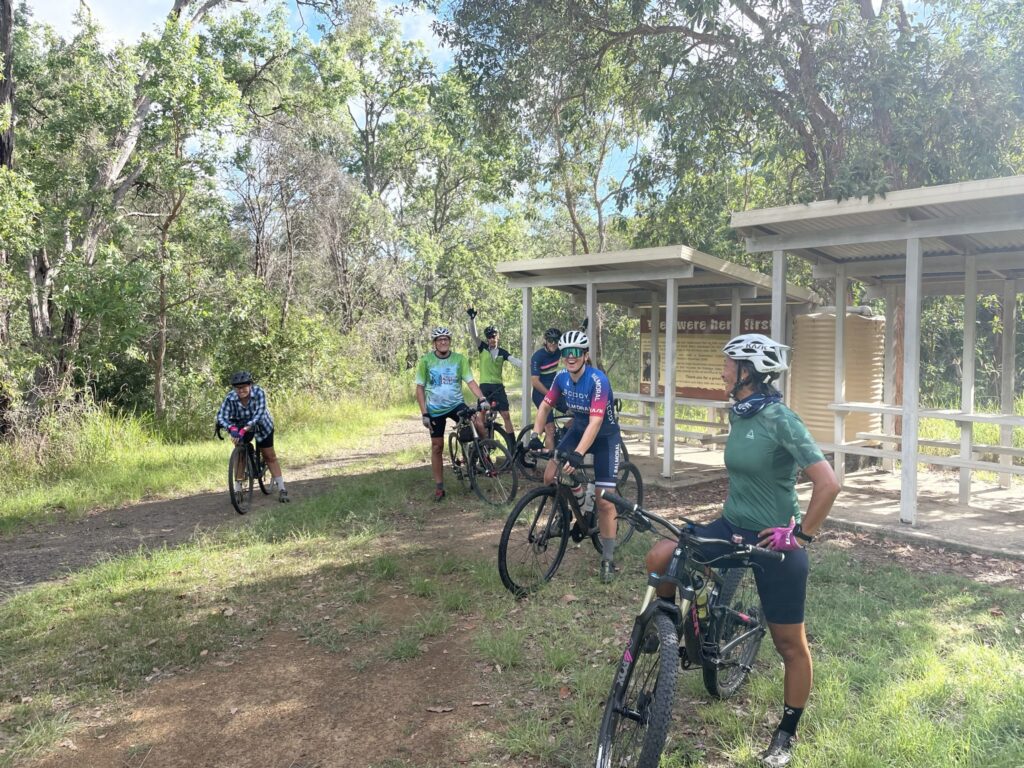
Rides
Discover our menu of local cycling routes.
Western Eastern Branch link
- Distance: 20.06km
- Difficulty: Moderate
- Elevation: 487m
- Est. Moving Time: 2:00:00
A short MTB loop around Mt Stanley through the forest for moderate to advanced riders.
Download Route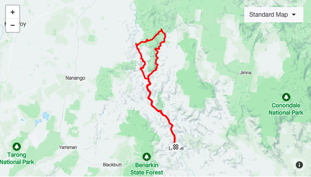
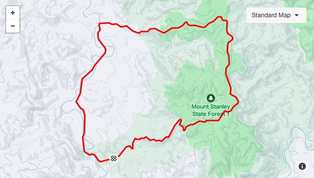
Two Branches Mt Stanley Loop
- Distance: 90.57km
- Difficulty: Advanced
- Elevation: 1,566m
- Est. Moving Time: 6:30:00
A full day MTB for advanced riders.
Download Route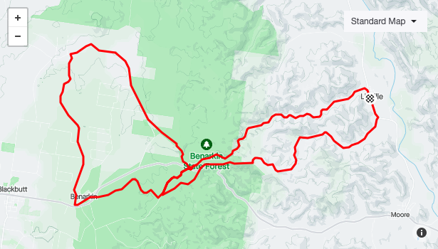
Rohlmanns Roll
- Distance: 53.63km
- Difficulty: Moderate
- Elevation: 719m
- Est. Moving Time: 4:00:00
A half day MTB ride exploring the ridges between Linville and Benarkin featuring Jessies Well, Fire Tower, Bora Ring and spectacular views.
Download Route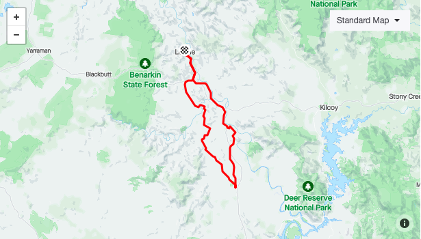
Linville Toogoolawah Moore Loop
- Distance: 73.86km
- Difficulty: Intermediate
- Elevation: 696m
- Est. Moving Time: 4:30:00
A dry weather gravel / MTB half day suitable for intermediate riders.
Download Route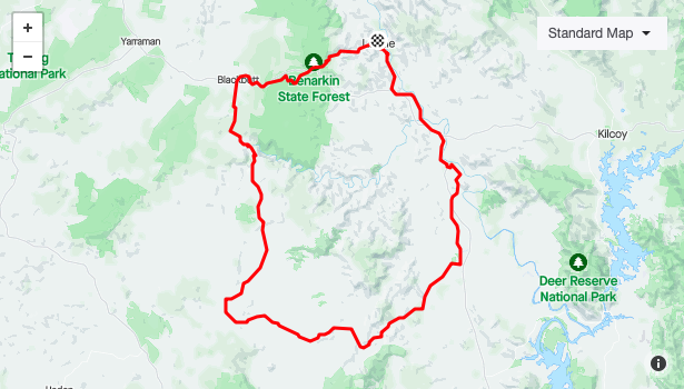
Linville Toogoolawah Anduramba Blackbutt Loop
- Distance: 134.74km
- Difficulty: Advanced
- Elevation: 2,168m
- Est. Moving Time: 9:00:00
For experienced riders, a full day gravel / MTB ride exploring roads less travelled. Dry weather only.
Download Route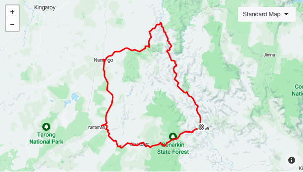
Linville Nanango Loop via BVRT
- Distance: 125.59km
- Difficulty: Moderate
- Elevation: 1,807m
- Est. Moving Time: 8:00:00
Moderate MTB / gravel. One big day or two days with stopover in Nanango.
Download Route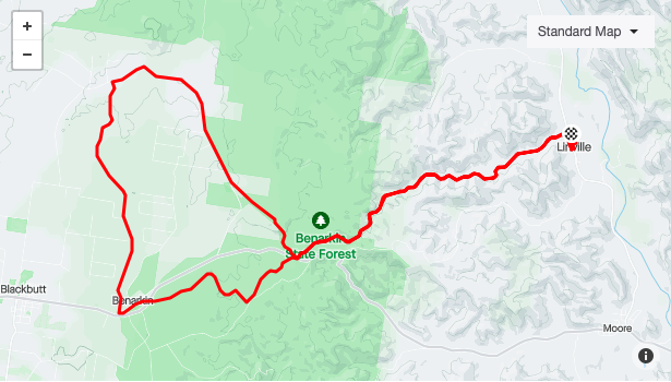
Linville Benarkin Allery Trail Loop
- Distance: 48.54km
- Difficulty: Moderate
- Elevation: 508m
- Est. Moving Time: 3:30:00
A half day explore of places just off the rail trail such as Jessies Well and Fire Tower.
Download Route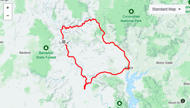
Linville Kilcoy Loop
- Distance: 114.79km
- Difficulty: Moderate
- Elevation: 1,378m
- Est. Moving Time: 7:00:00
A full day gravel loop following Monsildale Creek before heading to Kilcoy then returning to Linville via Gregors Creek and BVRT.
Download Route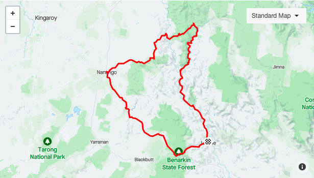
Linville Nanango Loop Epic
- Distance: 128.20km
- Difficulty: Advanced
- Elevation: 2,425m
- Est. Moving Time: 9:00:00
Advanced MTB. Dry weather only beyond the BVRT. May be done over one or two days with stopover in Nanango. Similar to Linville Nanango loop via BVRT but goes through Old Coach Road and diggings area and explores Mt Stanley east and western branches of the Brisbane River.
Download Route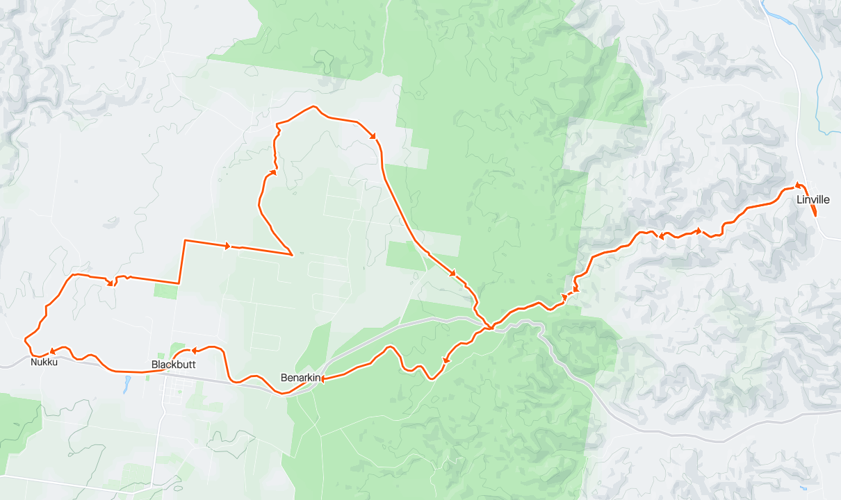
Pioneer and Allery Trails
- Distance: 62
- Difficulty: Moderate
- Elevation: 710 m
- Est. Moving Time: 4:00:00
Moderate Gravel or MTB. Fun technical riding with some hike a bike through creeks.
Download Route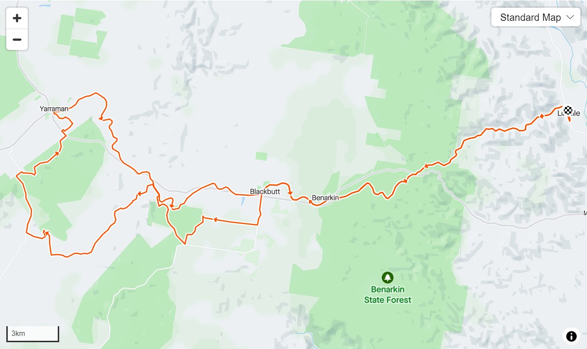
Linville Blackbutt Yarraman loop
- Distance: 100
- Difficulty: Moderate
- Elevation: 1000 m
- Est. Moving Time: 6:00:00
For the gravel bike riders although MTBs are fine, some climbing and a variety of scenery. The ride goes through Blackbutt twice and the town of Yarraman so heaps of places to refresh if necessary.
Download Route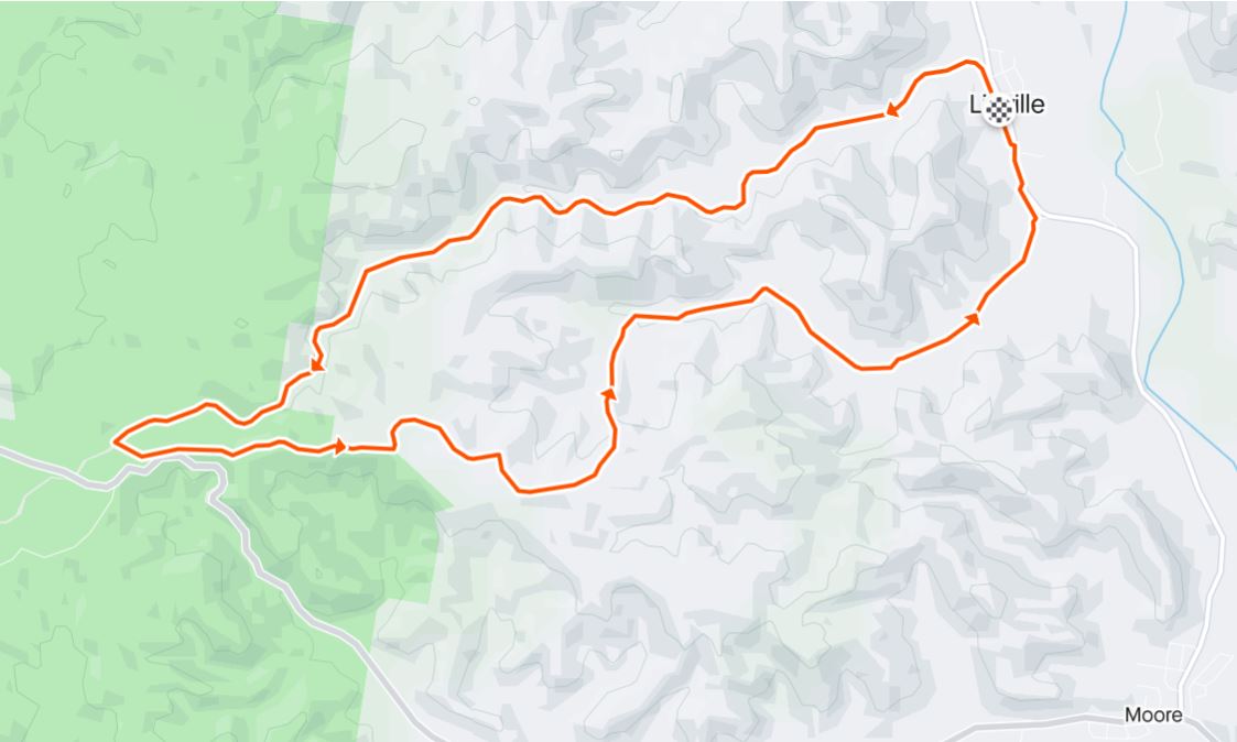
Short Rohlmanns loop
- Distance: 23.5
- Difficulty: Moderate
- Elevation: 400 m
- Est. Moving Time: 2:30:00
Head up the rail trail and take a left hand turn before you get to the Allery trail exit. Includes a steep decent which can be slippery and may prove challenging, walk if in doubt. More comfortable on a MTB,. Make sure you have sufficient water in hot weather as much of the ride is exposed..
Download Route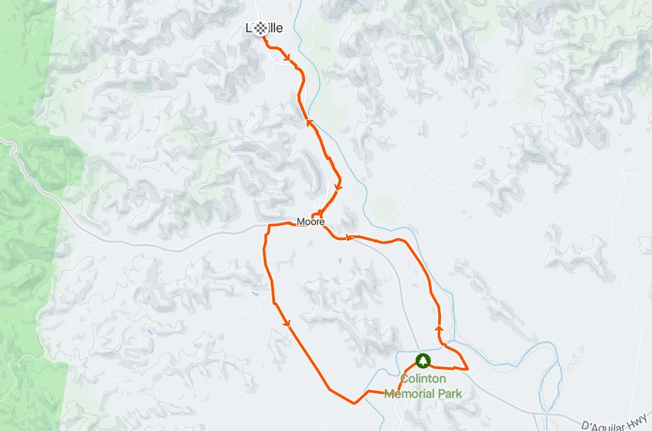
Moore Colinton Stock Route loop
- Distance: 33
- Difficulty: Easy
- Elevation: 300 m
- Est. Moving Time: 2:30:00
A short ride that explores the stock and goes through Moore and Colinton. Involves crossing the Brisbane Valley Highway to get back on the rail trail at Colinton. Perfect for gravel bikes.
Download RouteThe ideal location
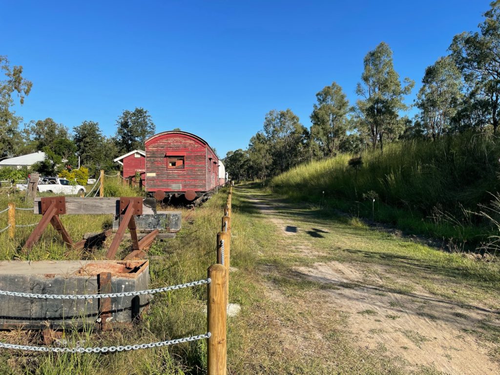
The Rail Trail Refuge is the ideal location to access the various legs of the Brisbane Valley Rail Trail.
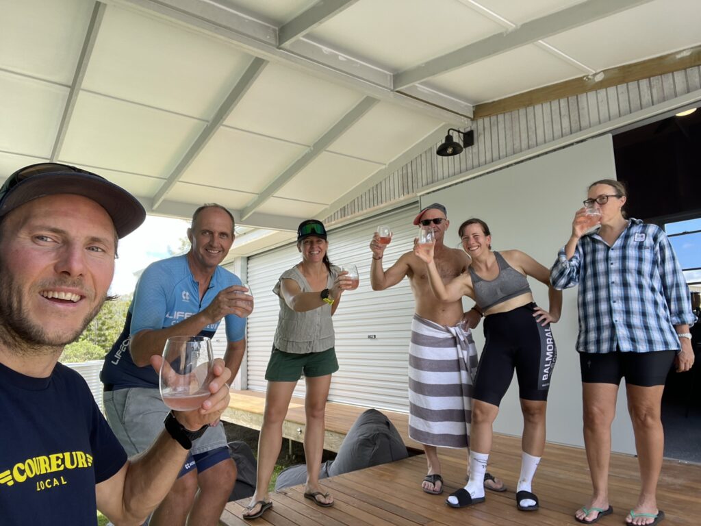
BOOK NOWGallery
Rail Trail Refuge provides purpose built accommodation for cyclists and other adventurers of the Brisbane Valley Rail Trail and Linville surrounds.


Contact Us
Our vision is to provide cyclists with an ideal place to relax, refresh and rest after a long days ride. Having experienced bike packing at home and abroad we have learned what makes a great overnight stay. These learnings have been incorporated into the Rail Trail Refuge allowing you to pack light and wake up ready for the next day’s adventure.
We hope you enjoy your stay at our Rail Trail Refuge.
Chevonne and John